
The largest dune field in North America lies not within the arid basins of Death Valley, or in the dune-themed National Park in southern Colorado, but just south of the Arizona border in El Pinacate and Gran Desierto de Altar Biosphere Reserve. These dunes, boasting a whopping 1.4 million acres of sand, make their home in the hottest, driest part of the hottest, driest desert of North America. A phenomenal trail to the eastern perimeter of the dunes made for a fantastic day hike when visiting this safe and beautiful part of Mexico.

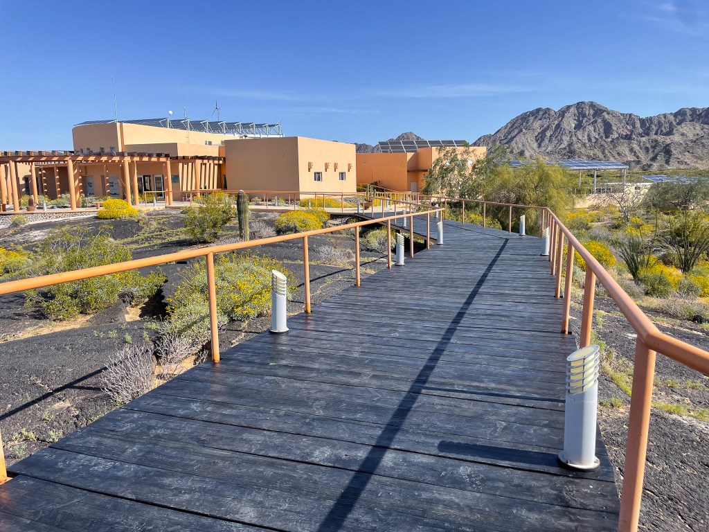
Hiking the dunes first requires a check-in at the Schuk Toak museum, a well-curated visitor center that can provide context to the landscape of El Pinacate. The park and museum employee spoke as much English as I did Spanish, so it was a beautiful disaster fumbling through our conversation, but my message landed: “Quiero visitar las dunas por favor.” During my visit in March 2024, the cost was 109 pesos to access the dunes and 60 pesos for admission to the museum.
In American National Parks, you can stroll up to a trailhead and hike with little to no knowledge or oversight. However, in Mexico, the park employee gave me a mandatory, exceptionally detailed rundown of the trail and the road leading to it. I never figured out if this is standard procedure for everyone, or a trauma response to incidents involving stupid Americans. But after not too long, I was off on an old road in a grassy expanse towards the edge of the dune field. The road was in good condition even after a rainy winter, and could probably be navigated by less appropriate vehicles than my Subaru.

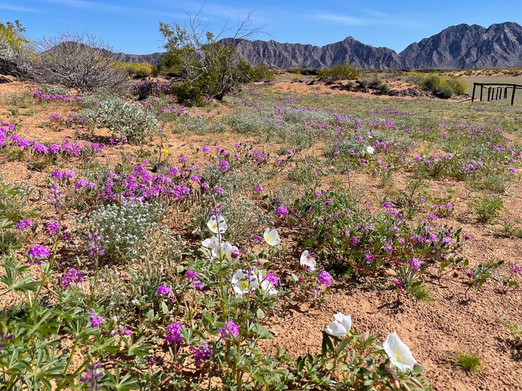
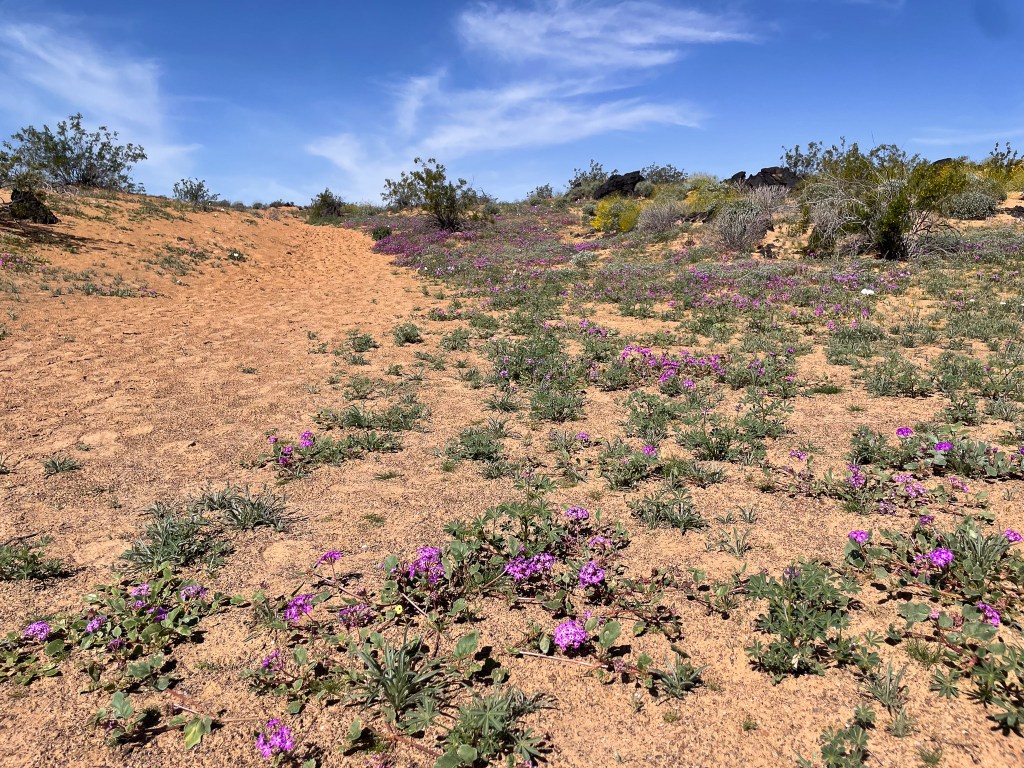
Upon arrival at the parking lot, I’m immediately intoxicated by the aroma of Sand Verbena. Since southern Arizona and the Alto Golfo region of Mexico received 150-200% of their average winter precipitation in ‘23-’24, a veritable super-bloom has graced large swaths of the region. Wildflowers like the profuse and purple Sand Verbena, Narrow-leaved johnstonella, evening primrose, desert sunflowers, desert marigold and lupine all add splashes of color to the fringes of these dunes.
The trail was surprisingly easy to follow, unlike many of the trails that explore dunes in the states. The path is marked by occasional tall red flags and yellow signs, and most obviously a stampede of footsteps. Every quarter mile or so, there is an interpretive sign (in both English and Spanish) talking about the flora, fauna and natural history of these dunes and the greater Alto Golfo region.
Very little plant-life can withstand these insane conditions, and those that can are either the most tolerant plants of the Sonoran Desert, or specialized to live in dunes, such as Galleta Grass, Sand Food and Dune Buckwheat. Chuckwallas and sidewinder skitter their way around the sand, and this little blister beetle may have accidentally met her demise by my foot if not for her vibrant color.

The easternmost portion of the dunes of the Gran Desierto de Altar sit atop the volcanic underbelly that constitutes El Pinacate. This lava flow, called the Ives lava flow, erupted eons ago out of the Sierra Pinacate, the big volcanic range visible to the north. Along the trail, you’ll often find the lava protruding from the sand like a dilapidated roadbed.

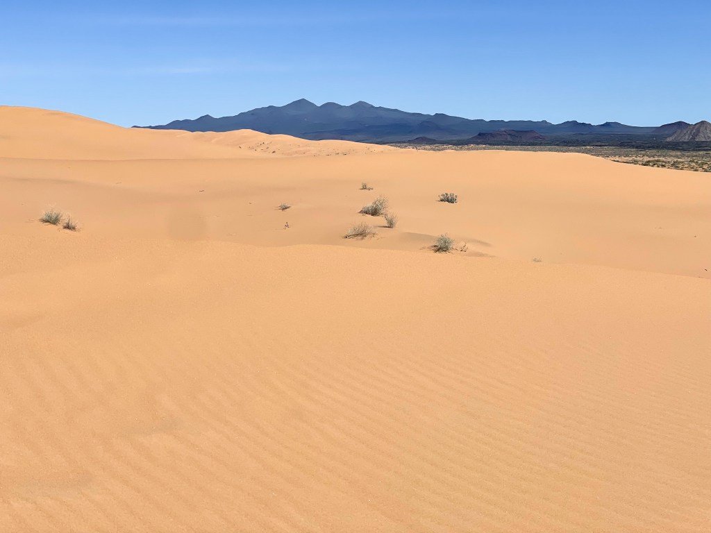
Farther along, the star dunes finally come into view. The sands of these dunes were deposited tens of thousands of years ago by the Colorado River, which in its ancestral form used to run from Yuma in a south-south easterly beeline to the Adair Bay. While the river now runs to the northwestern-most point of the Gulf of California, the sands remain, sculpted by wind and heat into the form they are at present.

The official trail ends at the beginning of these star dunes, where footsteps and an obvious route guide hikers to the tallest visible dune straight ahead. This climb becomes gradually more difficult, and the well-marked footsteps are slowly lost to human attrition and wind. As one gets closer to the tallest dune, the grade becomes quite steep, and views back towards the east of the granitic Sierra Blanca are excellent.

It’s not until reaching the top of this dune that a true 360-degree view is enjoyed. One will know when you’ve reached the tallest dune in the area when views open up to the west. These westerly views show the interminable sea of dunes, bound only by the Colorado River delta nearly 100 miles away. To put this into perspective, these dunes cover 17x more land area than the dunes of Great Sand Dunes National Park. To the north, the jagged, dark skyline of the Sierra Pinacate juts out of the sandy expanse.
To the south–in my opinion–lies the most impressive view. The resort hotels of Puerto Penasco are clearly visible on the horizon, and a thin blue strip of the Sea of Cortez is visible just beyond the southern dunes. The contrast between the arid and brutal landscape of the Gran Desierto de Altar and the cool and inviting waters of the Gulf of California is magical.


Leave a comment